This Infographic is designed by Recon Limited.
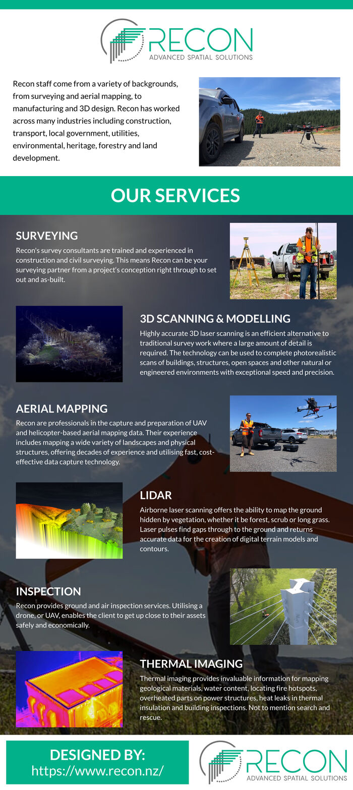
Land surveying and CAD drawing. Aerial mapping, contours, LiDAR, digital surface, and terrain modeling. 3D laser scanning and modeling, CAD, and Revit to support BIM - Building Information Management. Inspection services, thermal infrared mapping. NZ CAA certified drone operators carrying Pt102 certification.
Source: CAD Modelling Services